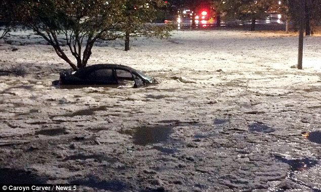
Jaw-dropping pictures posted on social networks reveal the devastation caused by massive hail storms which have swept through Colorado and Wyoming this week.
Destructive hailstones coated the ground so thickly that the landscape appeared to be covered in snow, KOAA reported.
Stunned residents took to Facebook and Twitter to share their photos of the bizarre weather, which blocked roads and left some cars almost totally submerged.
One picture in particular tugged at many heartstrings when it was posted by KDVR – a touching snapshot of a dog which sought shelter from the torrential downpour in a trash can.

The hail downpour was part of a powerful storm system that rolled through parts of Colorado and Wyoming on Thursday, packing heavy rains, high winds and hail.
The storms followed a round of nasty late spring weather that pummeled the region.
Preliminary reports show Colorado was hit by 10 tornadoes during the past two days.
The storms came at the peak time for such severe weather in the state. Severe thunderstorms normally become less common later in the month and in early July until summer monsoons start developing.
At least seven homes were damaged in Elbert County on the plains southeast of Denver.
County officials said two homes lost roofs and others had broken windows but the total damage was still being assessed.
Laura Van Why said she and her husband Dennis, their 2-year-old son and two dogs hid under the stairs of their basement while the storm passed near Kiowa, Colorado.
“It felt like forever,” Laura Van Why said.
“It was like, <<Black out the windows>>.”
Forecaster Jerry Claycomb, from the National Weather Service in Cheyenne, said the same factors created the storms in both states.
A low-pressure system stalled over northern Colorado and against the Laramie Range mountains southeast of Casper. That pulled up low-level moisture from the Gulf of Mexico from the southeast.
High-level westerly winds combined with low-level southeasterly winds to create what Jerry Claycomb called “shear”, which he said amounts to a turning in the atmosphere.
“It created these super cell thunderstorms over us, and those super cells created some tornadoes,” he said.
[youtube EY3Nw1Y4NV0]